Course Descriptions
Course Descriptions
Superior Hiking Trail

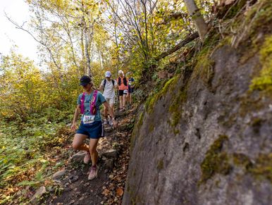
The Grand Traverse (27 Mile) start is located at the Palkie Road trailhead located just outside of Jay Cooke State Park. The first 2 miles are downhill! The old growth forest, hills, valleys and eskers make for a special trail experience.
The 21 Mile starts at the bottom of Ely's Peak, one of the high points of the 21 mile and 27 mile distance. Get ready to climb!
The 17 Mile starts by the Magney-Snively Park. This course starts by finding it's way down to the bottom and back to the top of Spirit Mountain. Get ready to descend and then go back up.
The 10 Mile start is located on Cody Street and N 66th Ave W, next to Traverse Duluth! Wildlife, waterfalls and great views await, the city of 80,000 is just below you and you would never know. This section has ups and downs and rocky ridges.
Superior Hiking Trail
Superior Hiking Trail

All distances are a point to point courses on the Superior Hiking Trail. This means no loops, no out and back and all new scenery and terrain through-out the entire course.
All course markings are the Superior Hiking Trail blue blazes. Some of the tricky intersections are marked with Grand Traverse markers. The entire course is on the Superior Hiking Trail so blue blazes trump all other markings. Pay attention and know where you are.
Duluth area Superior Hiking Trail sections information is available on the SHT website.
Trailhead Locations

All distances are point to point. Trailheads offer parking and access for spectators and support crew.
Parking is very limited at each trailhead. Participants are strongly encouraged to ride the shuttle bus to starting trailheads.
The Grand Traverse start of 27 Mile and 17 Mile are not aid stations. The start of the 21 Mile is at an aid station. The start of the 10 Mile is located next to Traverse Duluth and is a bonus aid station.


